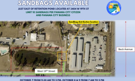
As of 1 p.m. CDT Wednesday, October 7, Tropical Storm Isaias continues to strengthen while moving toward the northern Gulf Coast.
The National Hurricane Center reports that Isaias has maximum sustained winds of 50 mph and is moving east-northeast at 8 mph. The storm is forecast to become a hurricane Thursday as it approaches the northern Gulf Coast.
Hurricane Watch Includes Bay County
A Hurricane Watch is in effect along the northern Gulf Coast from Bay St. Louis, Mississippi, to Indian Pass, Florida. This watch area includes Bay County and Panama City.
A Hurricane Watch means hurricane conditions are possible within the designated area, generally within 48 hours. Watches may be upgraded to warnings as the storm moves closer and forecast confidence increases.
A Storm Surge Watch is also in effect from the mouth of the Mississippi River eastward to Yankeetown, Florida.
The storm’s exact track, intensity and eventual point of landfall remain subject to change. Residents should continue monitoring official updates rather than focusing only on the center of the forecast cone, because wind, rain, storm surge and tornado threats can extend well beyond the center.
Potential Local Impacts
The City of Panama City says current forecasts could place the area on the eastern side of the storm. Additional rainfall is possible Friday through Saturday, along with the potential for isolated tornadoes.
Heavy rainfall could increase the risk of flash flooding, particularly in areas where the ground is already saturated from recent rain. Strong winds, coastal flooding and hazardous marine conditions are also possible as Isaias approaches.
State of Emergency Includes Bay County
Governor Ron DeSantis has issued Executive Order 26-202, declaring a state of emergency for 25 Florida counties, including Bay County.
The declaration allows state and local agencies greater flexibility to stage equipment, supplies and other resources in preparation for possible impacts. It is not an evacuation order.
Prepare and Stay Informed
Residents are encouraged to review their emergency plans, gather needed supplies, check their flood and evacuation zones and sign up for local emergency notifications through AlertBay.org.
Continue monitoring the National Hurricane Center, National Weather Service Tallahassee, Bay County Emergency Management and local government announcements for updated watches, warnings and protective instructions.
WKGC will continue sharing verified information as conditions and official guidance change.
This report is based on information from the Florida Public Radio Emergency Network, the National Hurricane Center, the City of Panama City and the Executive Office of the Governor of Florida.