
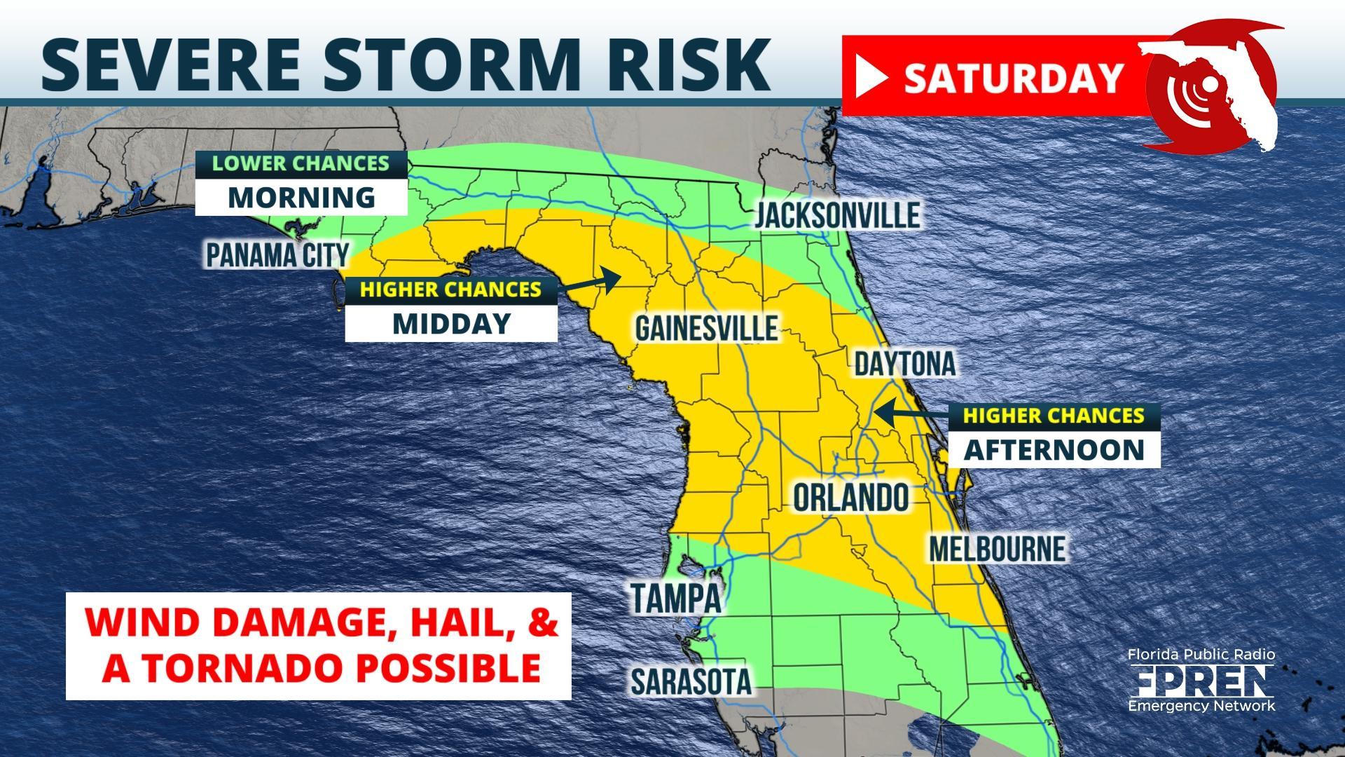
FPREN HQ – Wind damage, hail, and even a tornado are possible across portions of north and central Florida Saturday. A second and more widespread outbreak of severe weather is expected Sunday night across the Florida Panhandle.
Both events are tied to another strong storm system moving through the Southeast, nearly one week after the Easter Sunday outbreak that produced more than 100 tornadoes and claimed at least 36 lives.
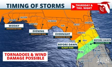
Saturday’s thunderstorms are expected to form or move along a warm front that will stretch roughly 50 miles either side of a line from Panama City to Ocala to Orlando. The boundary will separate slightly cooler and drier air to the north from an increasingly warm and humid air mass to the south. Forecast model simulations suggest clusters of thunderstorms will form along this boundary near the Nature Coast or Florida’s Big Bend region Saturday morning, then propagate east-southeast toward cities such as Ocala, Daytona Beach, and Orlando in the afternoon hours.
The primary hazard from Saturday’s storms will be large hail and wind damage, although a few rotating storms are possible that could produce a tornado. The cities as greatest risk (level 2 out of 5) include Cedar Key, Gainesville, Ocala, The Villages and Daytona Beach.
The risk of a tornado is a bit higher (level 3 out of 5) across the Florida Panhandle Sunday night or early Monday, although it’s a bit early to discuss precise timing and location of this event. Updates will be available on all of the severe thunderstorm threats this weekend on the Florida Storms app or social media accounts, and on your local public radio station through the Florida Public Radio Information Network.
Story by FPREN Meteorologist Jeff Huffman