
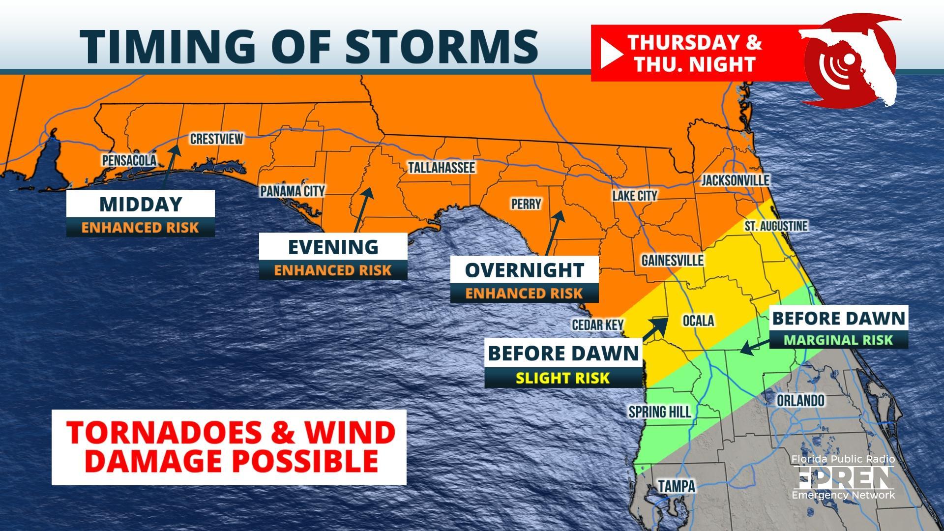
FPREN HQ – Damaging winds, large hail, and tornadoes are possible across North Florida beginning as early as tomorrow afternoon as a powerful low pressure storm system carves through the Deep South.
The risk of potentially destructive weather is greatest in the Panhandle Thursday afternoon and evening, followed by The Great Bend, North Central Florida, and northeast parts of the First Coast overnight into Friday.
Forecasters at NOAA’s Storm Prediction Center in Norman, Okla. have issued an Enhanced Risk (Level 3 out of 5) for the entire Florida Panhandle and much of northeast Florida for Thursday and overnight into Friday.
A lower risk was outlined for areas as far south as the I-4 corridor from Tampa to Orlando. The greatest storm risk, at this time, will likely continue across much of Central Florida Friday as the storm system pushes off into the Atlantic.
These storms will likely have the potential of producing large hail, damaging winds, and tornadoes, especially for areas located in the “Enhanced Risk” section. Heavy rain and localized flooding will also be possible.
This severe risk will decrease on Friday across portions of Central Florida, however, a thunderstorm capable of producing damaging wind and a tornado cannot be ruled out.
Conditions will begin to improve as the storm system pushes into the Atlantic late Friday. Cooler and drier air may briefly enter into the region behind the cold front. However, beginning Saturday another storm system is likely to develop across the Southeast which will keep showers and thunderstorms possible throughout North Florida over the weekend.
Story by FPREN Dr. Athena Masson
