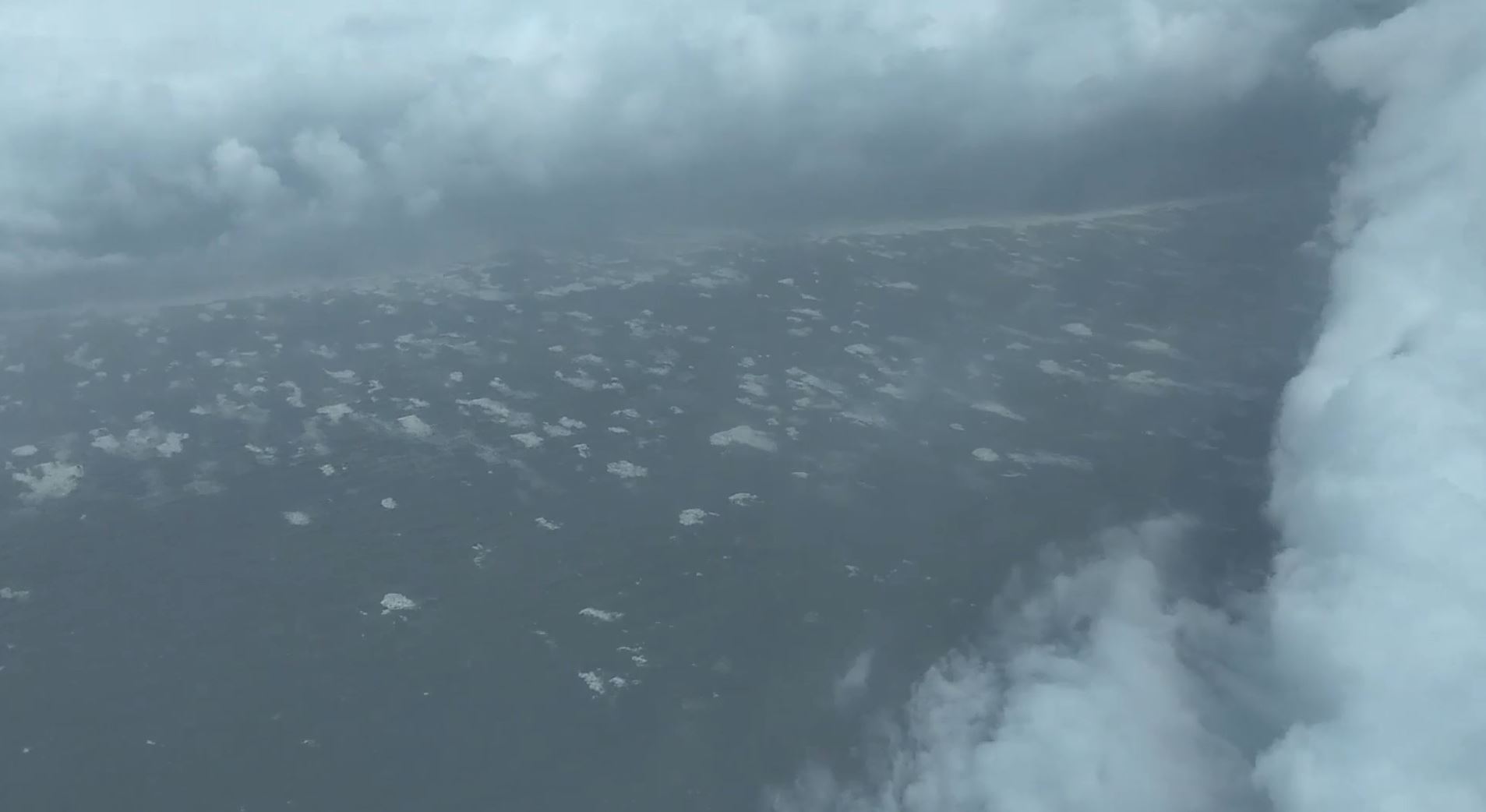
Keesler Air Force Base, MS – Video aboard the “Hurricane Hunters” Air Force Aircraft posted by the 403rd Public Affairs Office online a few days after Hurricane Michael made landfall, appears to show the coast line of Bay County as the Hurricane was beginning to make it’s landfall along the coast.
Members of the 53rd Weather Reconnaissance Squadron flew into the eye of Hurricane Michael as it made landfall, October 10th, 2018. The following mission was tasked by the National Hurricane Center and was known as mission 15. According to the data available, this mission made four (4) passes through the center of Hurricane Michael. The last flight through the center was just before 1215pm cdt (1715UTC), as Michael officially made landfall according to the National Hurricane Center around 1230pm cdt.
“Data from an Air Force Force Reserve Hurricane Hunter aircraft and NWS WSR-88D radar data showed that Michael continued to strengthen until it made landfall around 1730 UTC (12:30 PM CDT) along the coast of the Florida Panhandle between Mexico Beach and Tyndall Air Force Base. The aircraft found peak 700-mb flight-level winds of 152 kt during its final pass through southeast eyewall just before Michael made landfall. There were SFMR measurements of 132-138 kt, but the validity of those observations are questionable since they occurred in shallow water and were flagged. The landfall intensity was estimated at 135 kt (155 mph), which makes Michael the strongest hurricane to make landfall in the continental U.S. since Andrew (1992). The minimum pressure at landfall was estimated at 919 mb, which is the third lowest landfall pressure in the United States. A University of Florida/Weatherflow observing site measured a minimum pressure of 920.2 mb.” – National Hurricane Center Discussion Number 17
Cannot describe what we just experienced. My heart is still beating out of my chest! Plenty of pics/videos to come, but for now, here is the @53rdWRS crew that flew the landfall mission of historic Hurricane #Michael pic.twitter.com/5NCPwV7KV1
— Jeremy DeHart (@JeremyDeHart53d) October 10, 2018
The crew that flew last mission into Hurricane Michael from Air Force 53rdWRS, aka “Hurricane Hunters”.
During the mission, the aircraft which is a modified WC-130J for the Air Force Reserve that is stationed at Keesler Air Force Base in Bilioxi, Mississippi, will normally fly its reconnaissance mission in the system at 700mb, which normally correlates to 10,000ft above the surface. The normal storm flight pattern is called a “Alpha” pattern, which allows the aircraft to sample the storm in each quadrant of the system. This also allows the aircraft to pass through the center and generate center fixes, which then is sent to the National Hurricane Center.
To see mission 15 flight path and available data recorded by the aircraft (which was sent to the National Hurricane Center during the storm), please visit this link, courtesy of “tropicalatlantic.com“.
*The following videos were released on October 14th, 2018 by 403rd Wing/Public Affairs at Keesler Air Force Base.
At the one minute mark, video 1 appears to show the coast of Bay County as the aircraft banks right, then circles back to the right, and then begins to depart to the ESE. The coastline in the video would most likely be Tyndall Air Force Base at the “Saint Andrew Sound” entrance. Hurricane Michael makes landfall at Tyndall at 1230pm CDT, on October 10th, 2018 with an estimated pressure of 919mb and winds of 155mph sustained, according to the National Hurricane Center advisory number 17.
Click video to begin playing Video 1
(3/3) As the flight path shows, we made the fix then loitered in the eye for a bit to gather ourselves. The wx officer is usually busiest in the eye, so I had a rare opp to snap a pic and take in the moment. #Michael was every bit of the 919mb monster we measured. Unforgettable. pic.twitter.com/QJIG5tMJmb
— Jeremy DeHart (@JeremyDeHart53d) October 11, 2018
Watch closely and you'll see the beaches surrounding Saint Andrew Sound pass underneath the eye of #Michael pic.twitter.com/nx24eqKnAx
— Dan Hawblitzel (@dhawblitzel) October 10, 2018
Video 1 – Members of the 53rd Weather Reconnaissance Squadron flew into the eye of Hurricane Michael as it made landfall, Oct. 10, 2018. The Hurricane Hunters gather data from tropical cyclones, which is provided to the National Hurricane Center to assist in narrowing the path of the storm. (U.S. Air Force video by Master Sgt. Jessica Kendziorek)(The video speed was increased and a wing and unit patch was added.)
Click video to begin playing Video 2
Video 2 – This video is a fixed camera in the cockpit of aircraft facing out to the left wing. Members of the 53rd Weather Reconnaissance Squadron flew into the eye of Hurricane Michael as it made landfall, Oct. 10, 2018. The Hurricane Hunters gather data from tropical cyclones, which is provided to the National Hurricane Center to assist in narrowing the path of the storm. (U.S. Air Force video by Master Sgt. Jessica Kendziorek)(The video speed was increased and a wing and unit patch was added.)
Click video to begin playing Video 3
Video 3 – Members of the 53rd Weather Reconnaissance Squadron flew into the eye of Hurricane Michael as it made landfall, Oct. 10, 2018. The Hurricane Hunters gather data from tropical cyclones, which is provided to the National Hurricane Center to assist in narrowing the path of the storm. (U.S. Air Force video by Lt. Col. Sean Cross) (Video footage speed increased and music added.)
The National Hurricane Center continues to analyze and survey post storm damage and will issue its final report on Hurricane Michael in the coming weeks here.
The appearance of U.S. Department of Defense (DoD) visual information does not imply or constitute DoD endorsement.
(1/3) #Michael at landfall. The normal "stadium effect" was more like a cylinder, a straight vertical wall 50K ft high. Saw 175 mph flight level winds, ~155 mph at surface. Entered eyewall at 10K ft, ended up in eye down at 8K! Need another tweet to explain what that felt like… pic.twitter.com/lUqIhX9K0D
— Jeremy DeHart (@JeremyDeHart53d) October 11, 2018


