
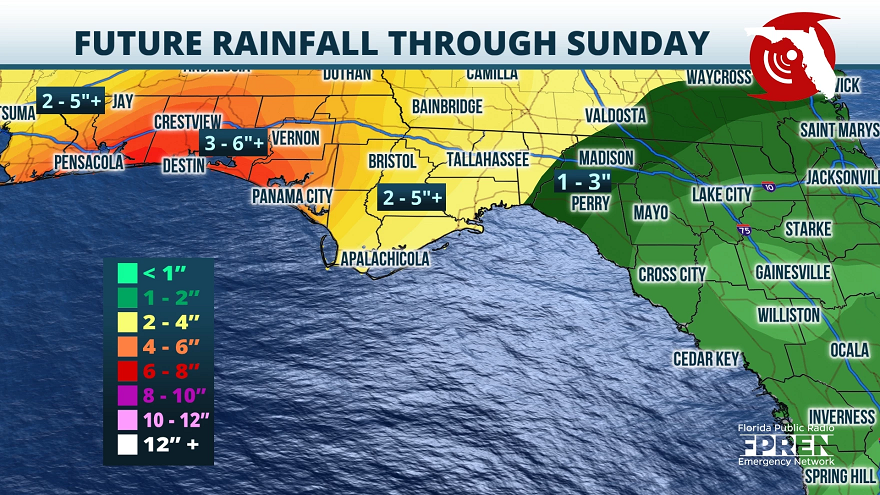
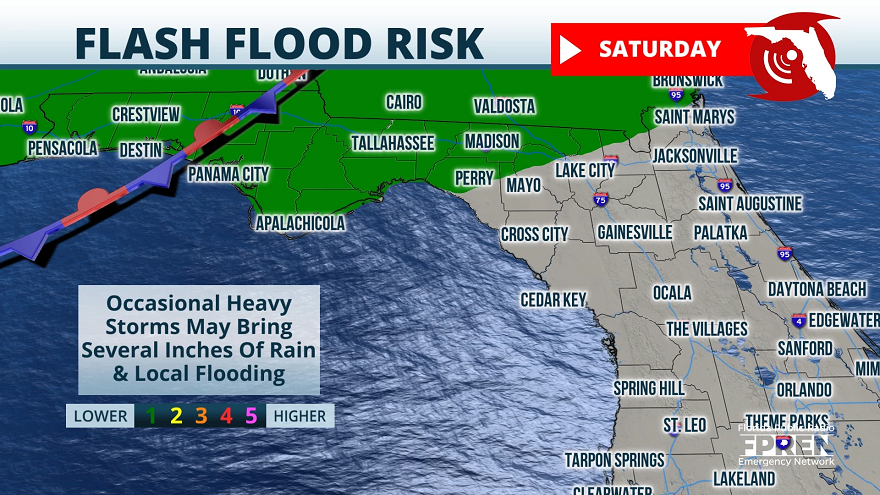
A frontal boundary will slowly track through the Florida Panhandle starting late tonight. Abundant moisture will increase ahead of the system causing rounds of heavy rain and isolated severe storms Friday through Sunday.
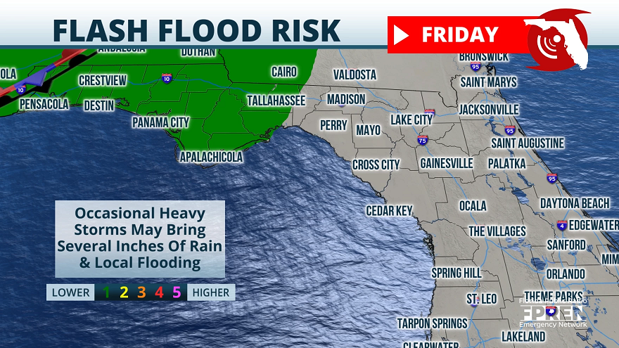
Precipitation chances will increase tonight through tomorrow morning, but the widespread, heavier showers are expected in Friday afternoon and evening. Because the front will take over 3 days to move through the Panhandle, local flooding will be the main threat. Most locations will average 2-4” with some areas picking up over 6”.
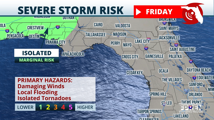
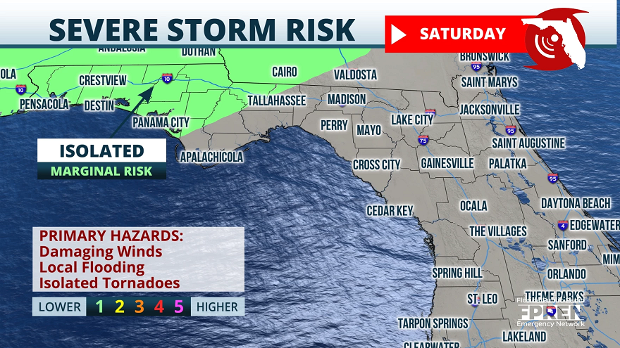
Widely scattered severe storms are also possible beginning Friday with risks for damaging winds and isolated tornadoes. Panhandle residents are reminded to plan around this stormy weather over the weekend and have multiple ways to receive watches and warnings. The higher winds associated with this system will also cause rough surf and increased risks for rip currents. These conditions combined with a threat for isolated waterspouts should discourage boaters and beachgoers from venturing to the coastline.
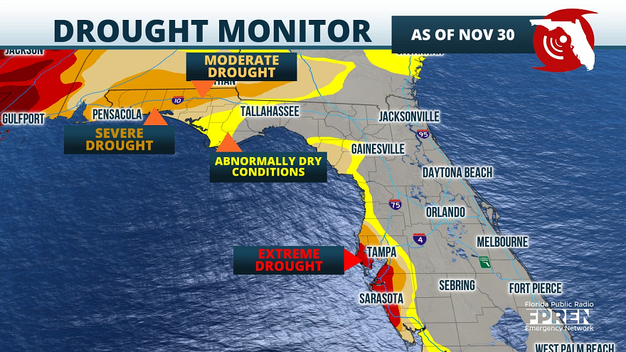
Flooding rains would normally be a bigger concern with a strong December system moving through the Panhandle. However, with the current drought conditions ranging from moderate to severe, much of this rain will be welcomed.
Please avoid those high waters and flooded roadways this weekend, and be sure to download the Florida Storms app for the latest watches and warnings.
Angela Small
Radio Production Assistant

