
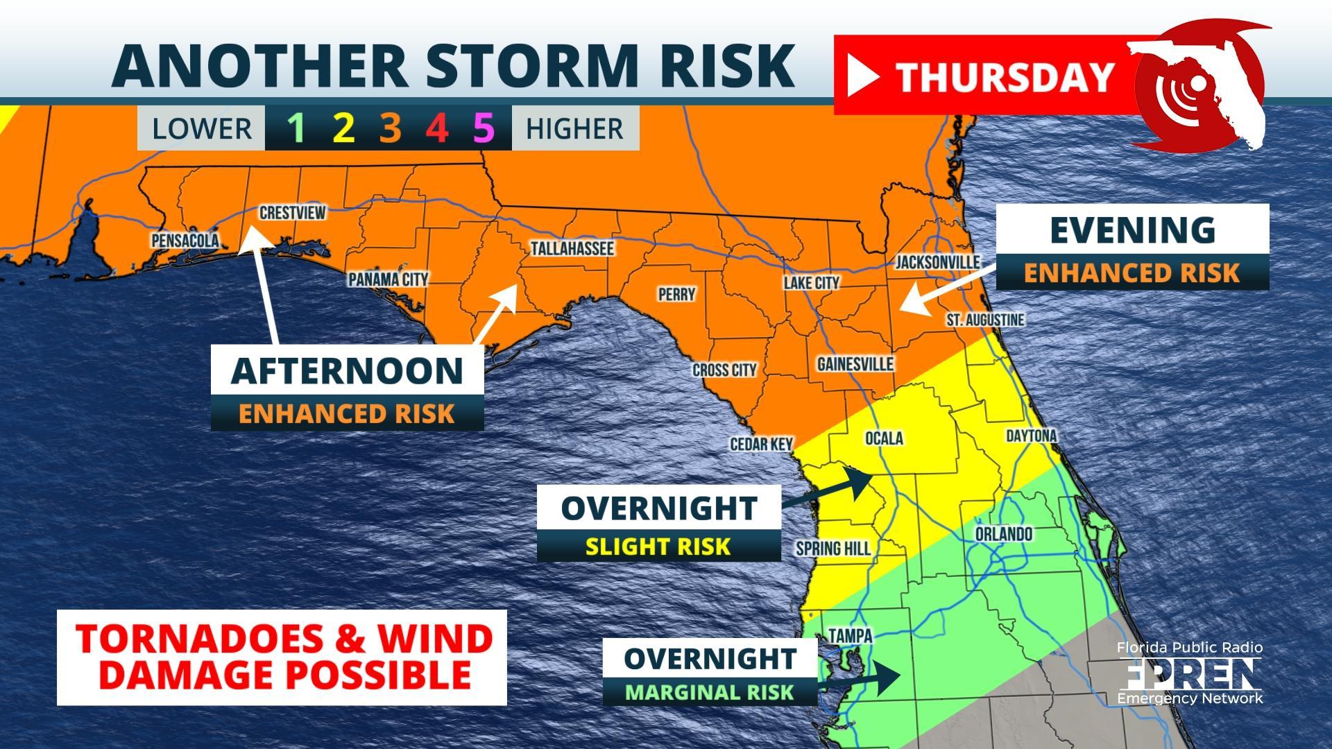
FPREN HQ – Tornadoes, wind damage and hail are possible again in parts of Florida for the second time this week.
Another strong storm system is poised to sweep across the Southeast Thursday Night and Friday, producing clusters of strong thunderstorms ahead of it. The risk of destructive weather is greatest in the Florida Panhandle Thursday afternoon and evening, followed by peninsular locations along and north of I-4 Thursday night and Friday.
In their Tuesday morning update, forecasters at NOAA’s Storm Prediction Center in Norman, Okla. identified all locations in the Florida Panhandle and much of northeast Florida as having an “enhanced” (level 3 out of 5) risk of the severe weather Thursday and Thursday night. A lower risk was outlined for areas as far south as the I-4 corridor from Tampa to Orlando. The strong storm risk will likely continue across much of Central Florida on Friday as the storm begins to pull away.
Primary hazards from the strongest storms in the enhanced risk area include tornadoes, damaging wind gusts, and large hail. Heavy rain and localized flooding will also be possible in these areas where multiple rounds of thunderstorms move through. The risk wains a bit on Friday across Central Florida, but a tornado or damaging wind gusts can’t be ruled out in these areas.
Drier and cooler air may briefly surge in behind the late-week front across North Florida, but yet another storm system is forecast to develop across the Southeast this weekend and potentially keep scattered thunderstorm chances in the forecast Saturday and Sunday.
Story by FPREN Meteorologist Jeff Huffman
