
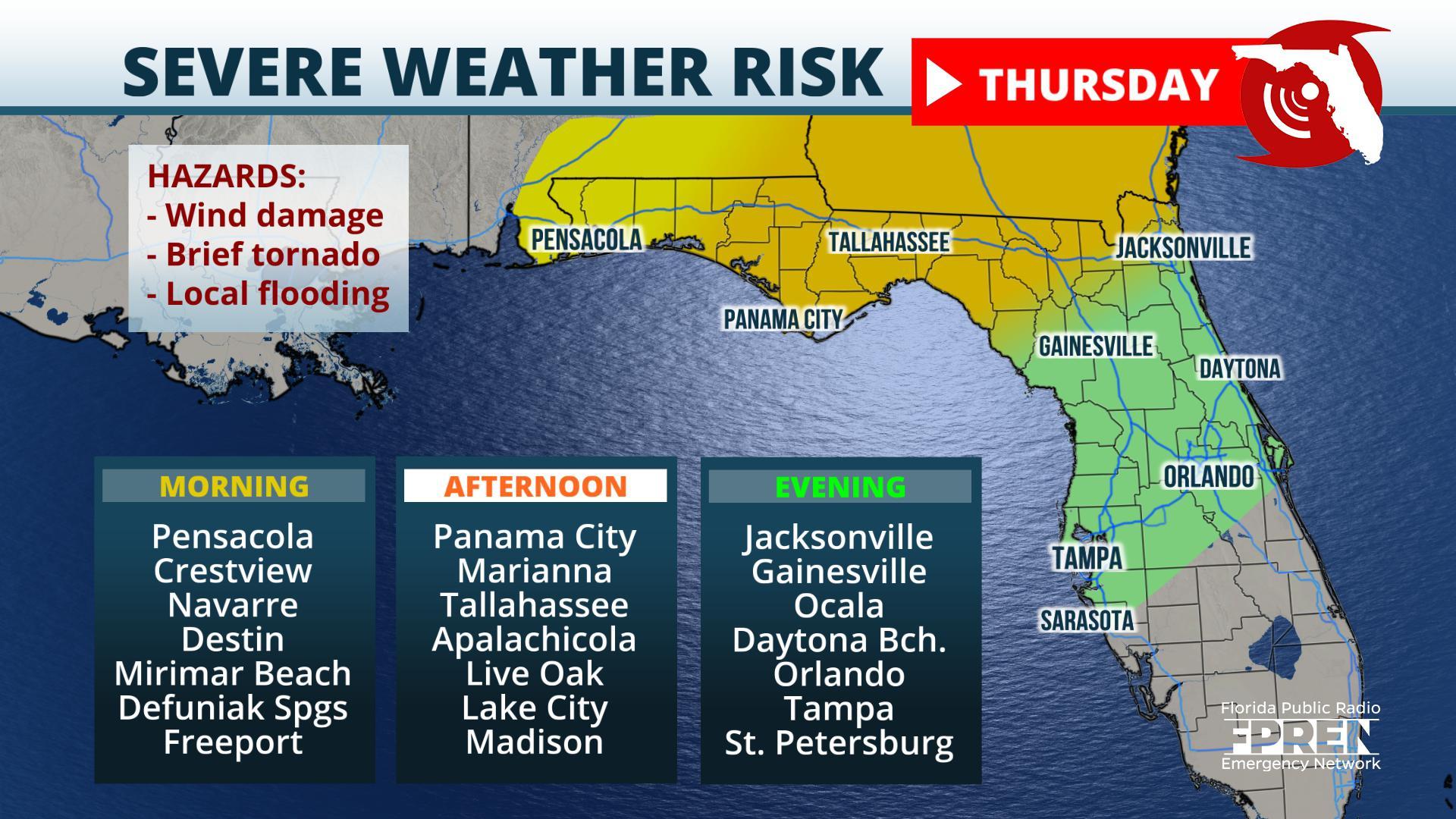
Panama City, Florida – Thunderstorms capable of producing wind damage, hail, or even a tornado are possible across the Florida Panhandle late Wednesday night, then most of north and central Florida Thursday and Thursday night.
Thunderstorms were off to an early start Wednesday, but confined primarily to areas near and north of the Alabama and Georgia borders.
Most t-storm activity is north of the #Panhandle this morning, but there are a few showers on the radar this hour. Showers and t-storms should remain along and north of I-10 during the day. A 2nd round of storms is expected to sweep through the entire Panhandle overnight. #FLwx pic.twitter.com/A8ybuWsD2H
— Florida Storms (@FloridaStorms) March 4, 2020
The morning activity was lining up along a nearly stationary front that stretched from South Texas to the South Georgia. An area of low pressure is expected to intensify along this boundary Wednesday night and move across the Gulf Coast states and into the Mid-Atlantic region Thursday. The greatest risk of severe thunderstorms will arrive just ahead of an approaching front associated with this system.
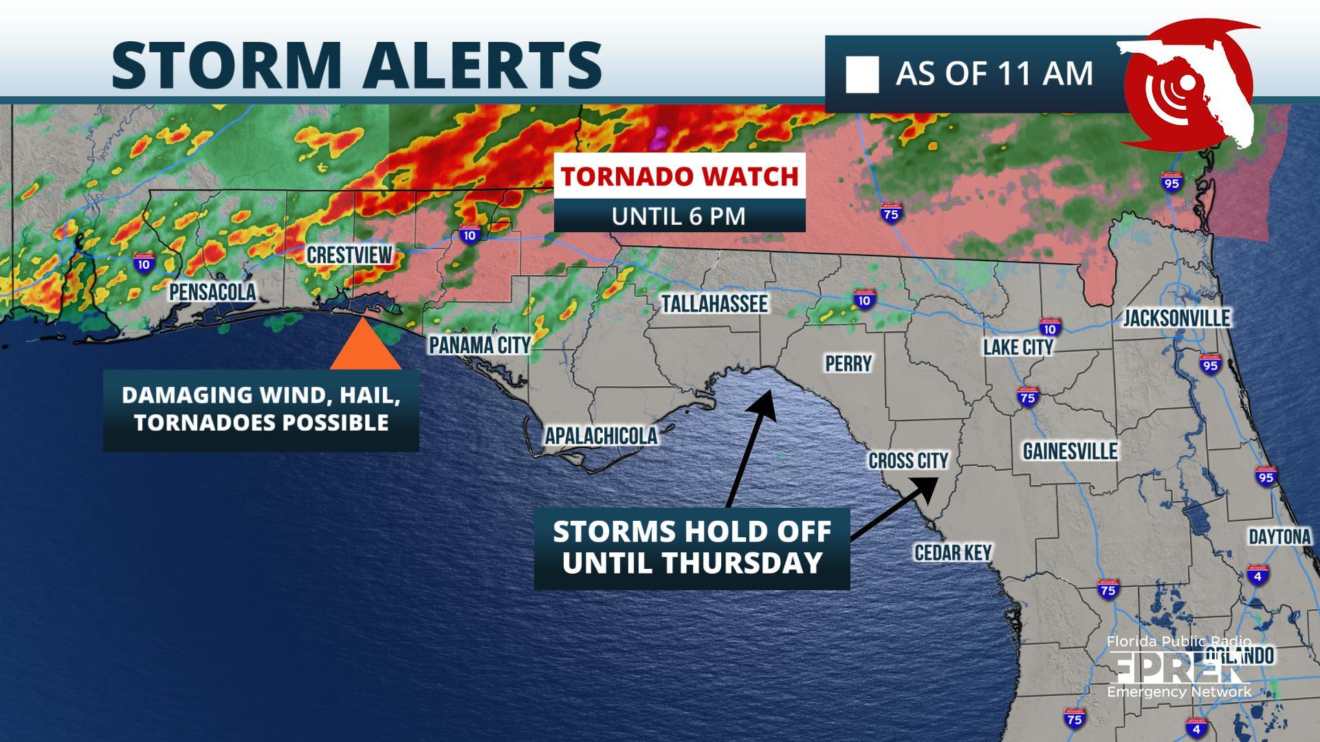
A Tornado Watch was issued for portions of the Florida Panhandle west of Tallahassee until 6 pm Wednesday, where a few strong cells could develop in advance of the main front arriving later tonight.
A more organized cluster of thunderstorms is likely to develop Wednesday evening across southern Mississippi and Alabama, then spread east into the Florida Panhandle overnight. The storms are forecast to move into (or redevelop across) the northern and central sections of the Floridan peninsula Thursday.
Rainfall amounts
The latest blend of computer model simulations are forecasting anywhere from an inch rain in the Jacksonville area to 2 to nearly 3 inches from Tallahassee westward through the Panhandle. These amounts reflect area-wide averages, but thunderstorms are almost sure to contribute heavier amounts in some areas. A “worst case” situation – rendered by an ensemble of computer models that create many possible scenarios to meteorologists — are indicating the potential for up to about 5 inches of rain in these areas. This scenario can become more probable where thunderstorms “train” or move over the same areas.
Flood potential
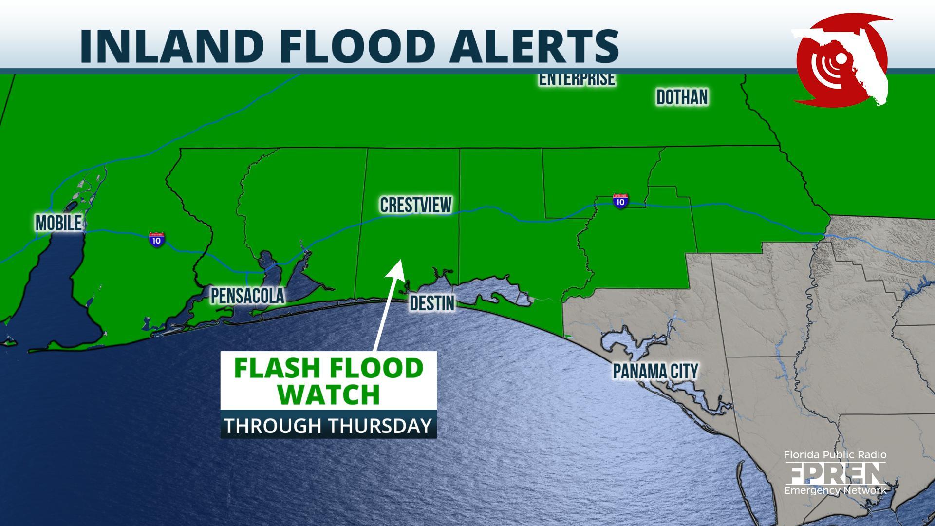
A Flash Flood Watch continues through Thursday morning for western sections of the Florida Panhandle.
Rainfall totals over the past 30 days in the Florida Panhandle have been running slightly below average for areas south of Interstate 10. However, areas along and north of I-10 have had more rain than usual and may be more susceptible to flash flooding. There is also a chance the Escambia River, which was experiencing minor flooding near Century for a time in February, could return to minor flood stage again if heavy rain falls in its watershed.

