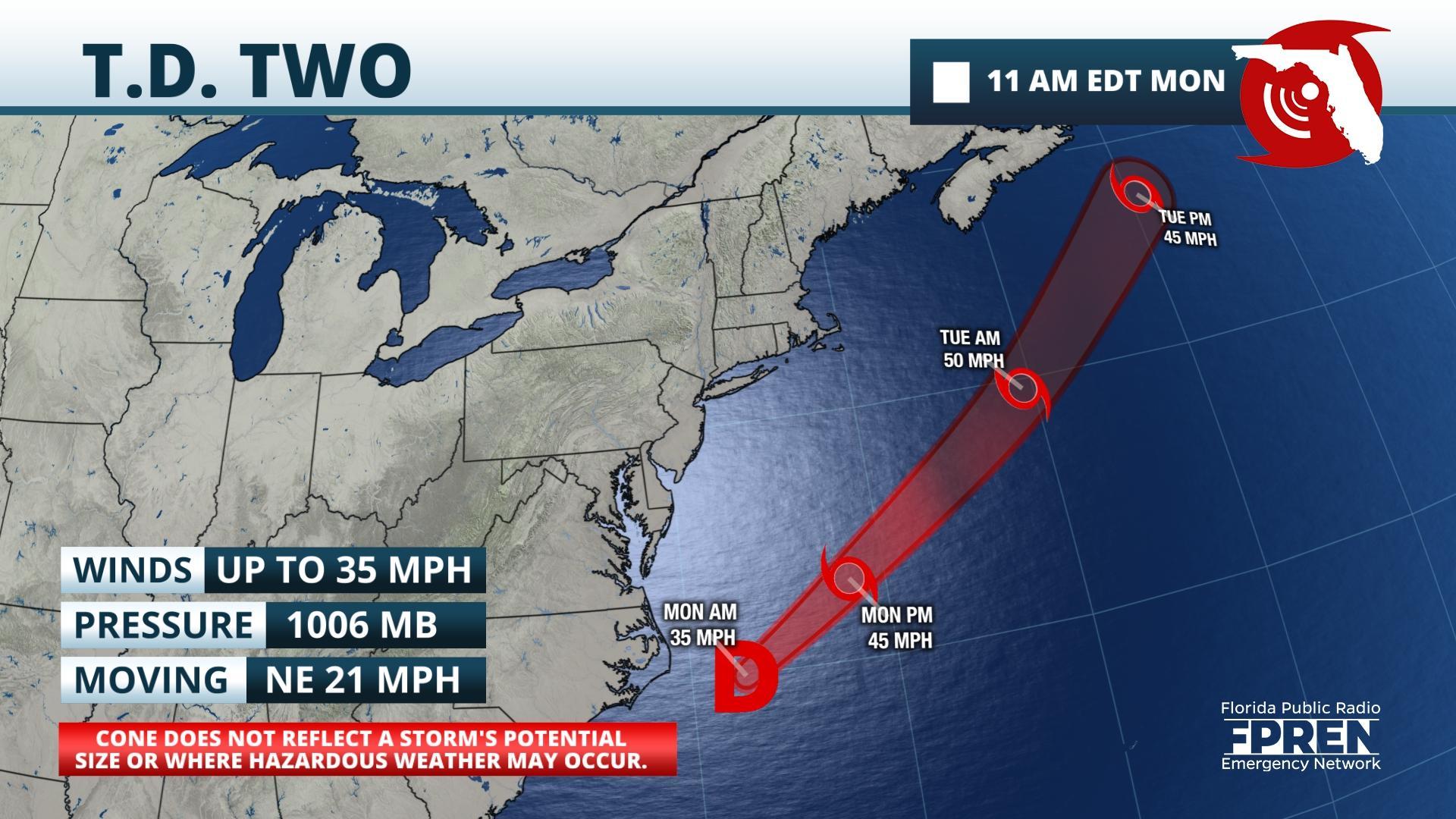
Gainesville, Florida – The season’s second tropical depression has formed a little more than 100 miles from Cape Hatteras, North Carolina. It is expected to strengthen into a tropical storm later Monday.
The depression formed along a decaying cold front near the Southeastern U.S. coastline. One of the most common ways that tropical systems form in June is when a mid-latitude low pressure area (often referred to as a “cold core” low in meteorology) or front moves over warmer ocean water. Over a couple of days, the low pressure area acquires warm core, or tropical, characteristics.
The steering winds between a trough in the eastern United States and a subtropical ridge over the Bahamas will force the system to move toward the northeast and away from the United States. There is enough warm water for strengthening as it moves over the Gulf Stream, but it is expected to transition back to a non-tropical low on Wednesday as it moves over the colder waters of the North Atlantic.
Story by FPREN Meteorologist Ray Hawthorne.


