
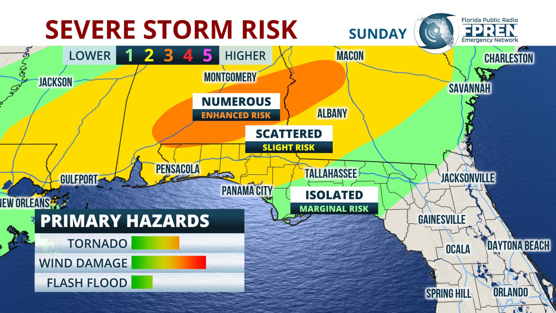
Gainesville, Florida – A fast-moving storm system could produce severe thunderstorms in portions of the Florida Panhandle Sunday afternoon and evening. The strongest individual cells pose the risk of a tornado. A squall line that follows could produce wind damage.
SUNDAY AFTERNOON TORNADO RISK
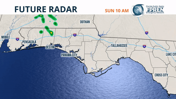
A warm front will be draped across the Florida-Alabama-Georgia border Sunday morning. This is the boundary that triggered a few isolated severe thunderstorms Saturday across North Florida as it was lifting north. An area of low pressure is forecast to strengthen across the Mid-South and ignite several clusters of thunderstorms along this boundary by early afternoon.
Atmospheric parameters are favorable for rotating storms in this environment, where Meteorlogist Chris Broyles from the Storm Prediction Center says multiple tornadoes are possible.
“The greatest potential for tornadoes is currently forecast from just north of Mobile east-northeast to the east of Columbus, Georgia.”
The enhanced tornado risk extends across the border into far northern sections of the Florida Panhandle, especially in the northern half of Escambia, Santa Rosa, Okaloosa, Walton, Holmes and Jackson Counties.
SUNDAY EVENING SQUALL LINE
Sunday afternoon’s thunderstorms are expected to quickly move northeast into Georgia and South Carolina by late afternoon. A few hours later, likely in the late evening hours, a cold front is projected to swing in from the northwest.
In his Saturday afternoon update, Forecaster Broyles explained that wind fields were “favorable” for squall line development with an associated wind damage threat. Gusts up to 60 mph will be possible along the leading edge of this line when it arrives, particularly where the strongest segments of thunderstorms line up. A tornado or two is also possible with this activity, especially if thunderstorms form just ahead of the squall line. This risk extends across the entire Florida Panhandle Sunday night, but chances for wind damage are highest in western and northern sections in the earlier evening hours.
The front that likely triggers Sunday’s severe weather outbreak is forecast to weaken as it moves across the Florida peninsula Monday, where mostly non-severe scattered showers and thunderstorms are possible.
This post will expire at 6:00 pm on Sunday March 3rd, 2019
Story by Meteorologist Jeff Huffman of FPREN. WKGC is the local FPREN station in NW Florida.
