
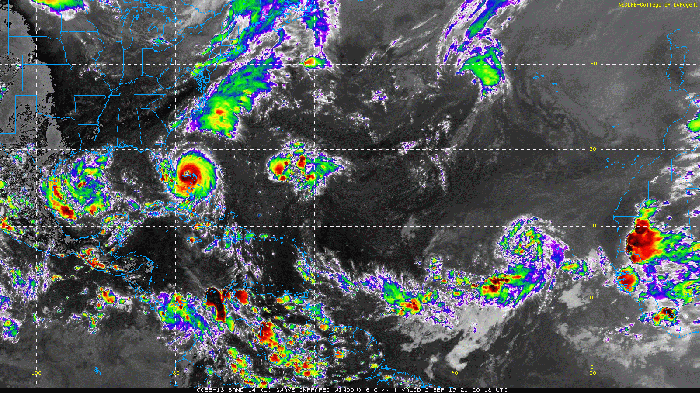
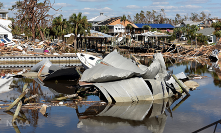
Panama City, Florida – All eyes are to the east coast of Florida where Hurricane Dorian has stalled less than 100 miles off the SE coast after slowly trekking through the Northwest Bahamas in the last two days, causing catastrophic and deadly storm surge and winds. The system had peaked at 185 mph winds at one point and had a pressure as low as 910 mb.
Climatology we are nearing the peak of the Atlantic Hurricane Season, which has only had 4 named systems. Looking forward for the next 5 days, several areas are being monitored by the National Hurricane Center.
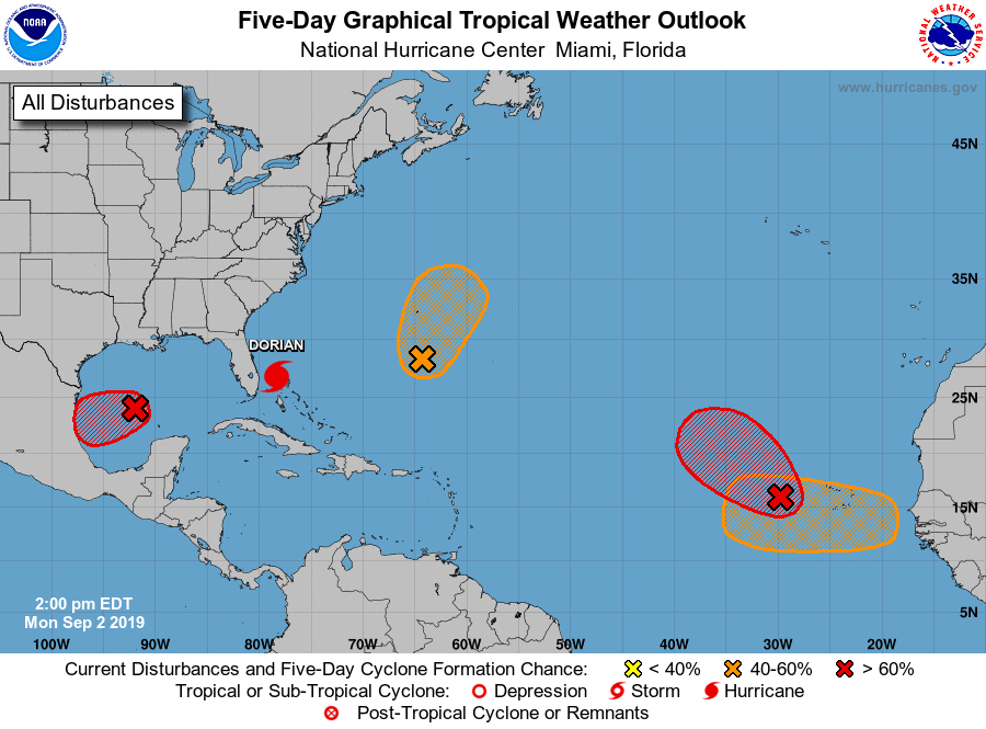
Tropical Weather Outlook
NWS National Hurricane Center Miami FL
200 PM EDT Mon Sep 2 2019
For the North Atlantic…Caribbean Sea and the Gulf of Mexico:
The National Hurricane Center is issuing advisories on Hurricane
Dorian, located near Grand Bahama Island.
1. Recent satellite-derived wind data indicate that an elongated area
of low pressure located a few hundred miles west of the Cabo Verde
Islands has become better defined since yesterday. Although this
system is currently producing limited showers and thunderstorms, a
tropical depression is expected to form during the next day or so
while the system moves generally northwestward across the eastern
tropical Atlantic Ocean.
* Formation chance through 48 hours…high…80 percent.
* Formation chance through 5 days…high…90 percent.
2. Showers and thunderstorms associated with an area of low pressure
located over the south-central Gulf of Mexico have become more
concentrated since last night. Recent visible satellite imagery
indicates that the surface circulation associated with the low has
also become better defined. Environmental conditions appear
conducive for additional development, and a tropical depression is
likely to form during the next two or three days while the low moves
slowly westward or west-southwestward toward the coast of Mexico.
Interests along the northeast coast of Mexico should monitor the
progress of this system.
* Formation chance through 48 hours…medium…60 percent.
* Formation chance through 5 days…high…70 percent.
3. A trough of low pressure is located several hundred miles
south-southeast of Bermuda. This system is producing persistent
shower and thunderstorm activity but does not have a well-defined
surface center. Some gradual development of the disturbance is
possible during the next few days and a tropical depression could
form while it moves slowly northward. Interests in Bermuda should
monitor the progress of this disturbance.
* Formation chance through 48 hours…low…30 percent.
* Formation chance through 5 days…medium…40 percent.
4. A tropical wave is forecast to emerge over the far eastern tropical
Atlantic between Africa and the Cabo Verde Islands in a few days.
Environmental conditions are forecast to be conducive for
development, and a tropical depression could form late this week or
over the weekend while the system moves westward to
west-northwestward.
* Formation chance through 48 hours…low…near 0 percent.
* Formation chance through 5 days…medium…40 percent.
Forecaster Zelinsky
Now is a good reminder to check your hurricane supplies and kit as we approach the middle of the season.
Get hurricane tips, forecast, evacuation routes, wkgc radio stream, and much more!