
Severe Weather Outlooks
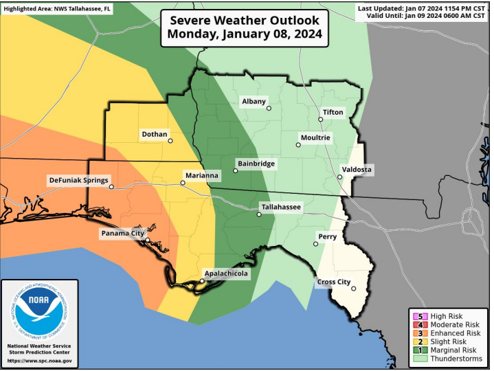
A significant severe weather outbreak is expected late tonight through Tuesday
The first round comes tonight, primarily across the Panhandle and southeast Alabama. This would be along and south of a warm front, where conditions could be favorable for discrete supercells. If this occurs, tornadoes (some strong) and damaging winds of 60-70 mph would be possible. Hail up to 1 inch cannot be ruled out.
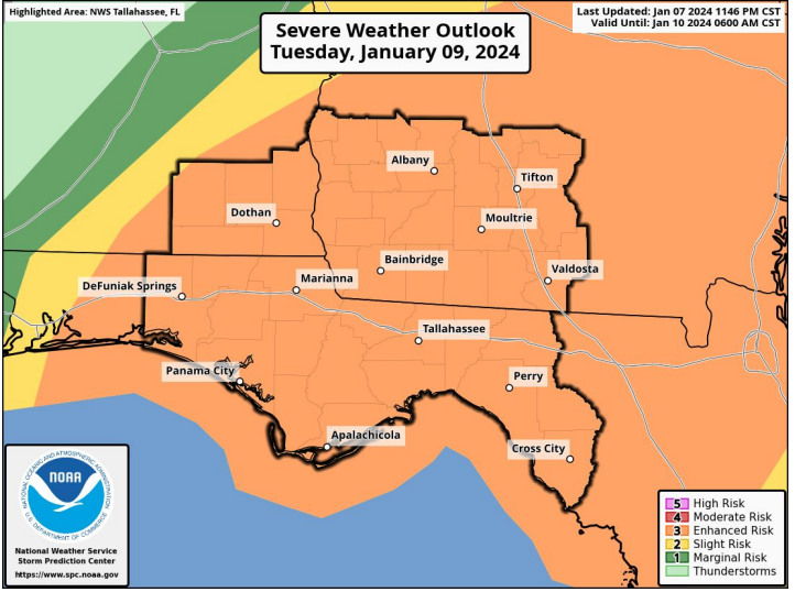
The second round (main event) comes during the day Tuesday as an intense squall line races through our area.
Overnight, the Storm Prediction Center upgraded the I-75 corridor of Georgia and the Suwannee Valley of Florida to an Enhanced Risk (level 3 of 5) for severe weather.
There is the potential for widespread damaging to destructive winds of 70+ mph with the squall line, in addition to
embedded tornadoes (some strong).
Today is the time to prepare for this significant severe weather event unfolding tonight and Tuesday.
Forecast Non-Thunderstorm Wind Gusts Forecast Rainfall Totals
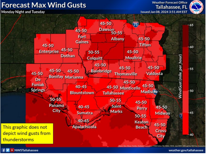
Strong, damaging wind gusts are expected across much of the area outside of storms tonight and Tuesday.
Wind gusts outside of storms are expected to reach 40-55 mph in most spots, though exposed beach locations could see gusts
near 60 mph.
Given wet soils, this could result in significant tree damage and power outages. Minor structural damage is also possible.
Forecast Rainfall Totals
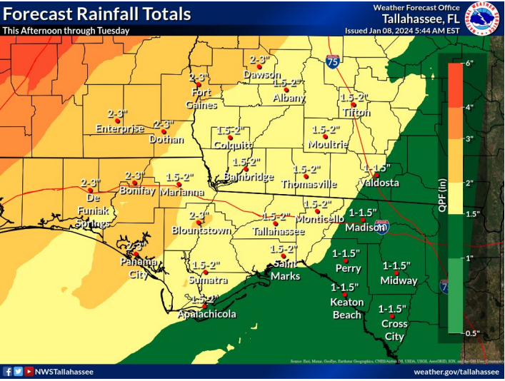
A widespread 2 to 3 inches of rain is expected through Tuesday, which could result in some localized flash flooding.
Localized totals of 3 to 5 inches are possible.
Several rivers could reach minor flood stage after the rain ends.
Wind Hazards
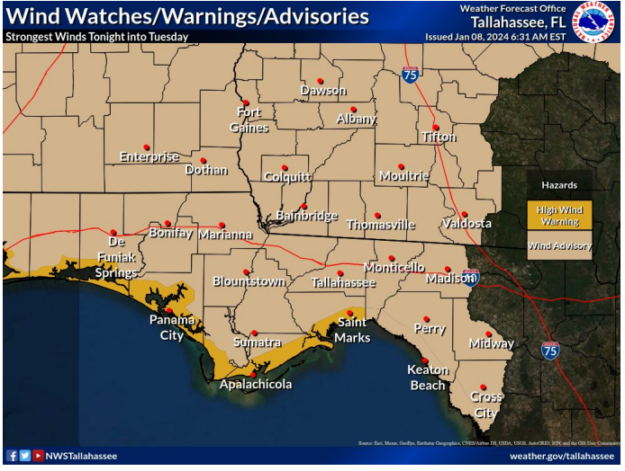
High Wind Warning from this evening through Tuesday afternoon for coastal areas from Wakulla County westward to
Walton County.
Wind Advisory tonight and Tuesday elsewhere
Storm Warning late today through mid-day Tuesday for the waters from the Ochlockonee River westward
Gale Warning tonight through Tuesday evening eastern Apalachee Bay.
Coastal & Marine Hazards
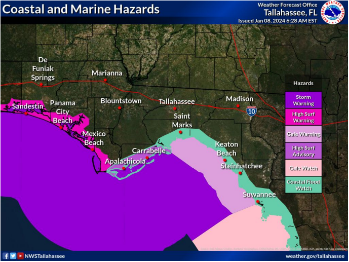
Coastal Flood Watch from Tuesday into Tuesday night from Indian Pass to the Suwannee River.
Minor to Moderate coastal flooding around coastal Apalachee Bay
High Surf Warning Walton, Bay, and Gulf County beaches
High Surf Advisory Franklin County beaches
For more information, visit National Weather Service Tallahassee, Florida
Angela Small
Radio Production Assistant
