
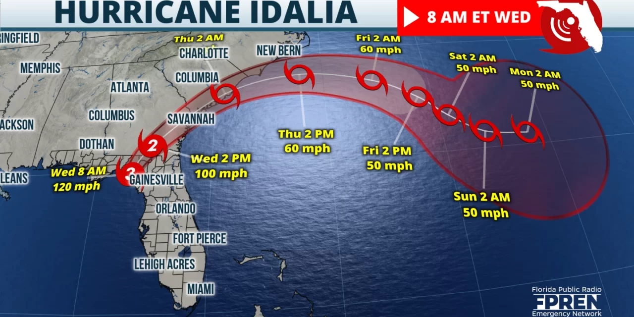
FPREN HQ – Hurricane Idalia officially made landfall as a Category 3 Major Hurricane with sustained winds of 125 MPH near Keaton Beach at 7:45 EDT. The strong winds have caused scattered to widespread flooding and power outages. Other damage has been reported along the Big Bend Coast.
The significant storm surge threat will continue for through early afternoon along coastal areas, especially the Big Bend Coast. The highest report so far has been inundations nearly 7 feet around Cedar Key.
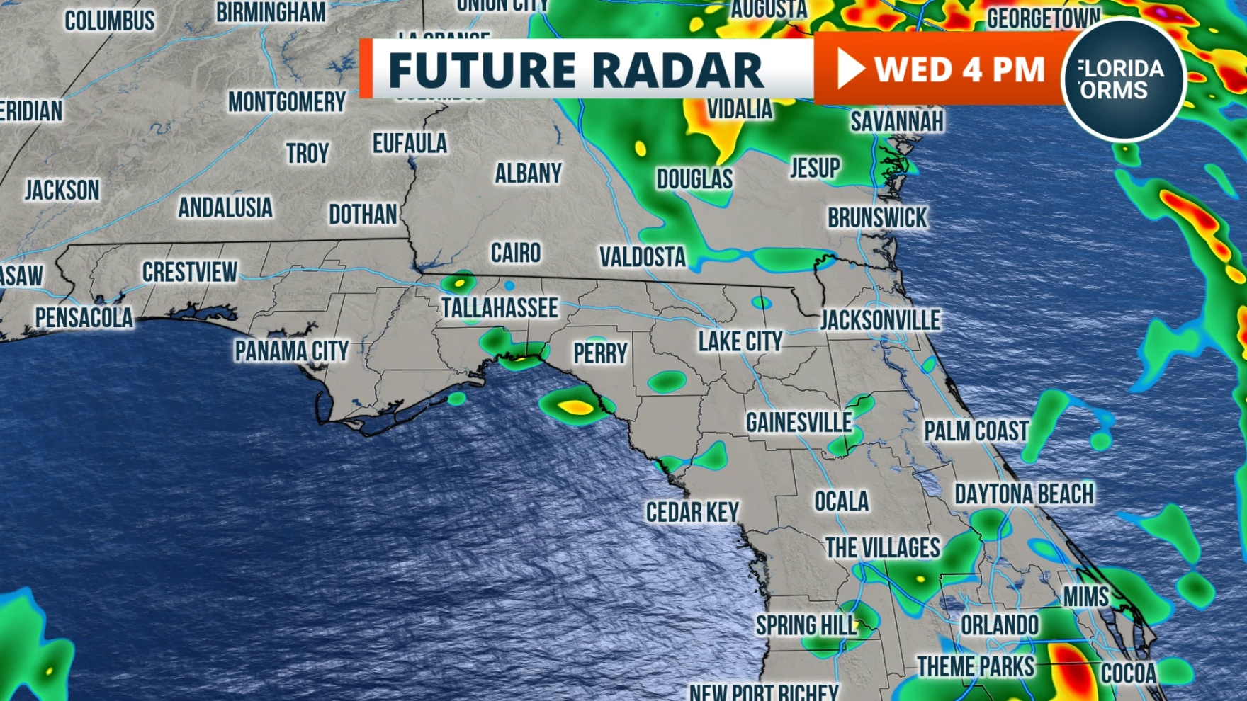
Heavy rain, flash flooding, and isolated tornado threats will continue through mid-late afternoon across north Florida. Scattered to widespread power outages and other wind damage is expected until Idalia’s center of circulation tracks well into Georgia later this afternoon. Many roads have also been closed across parts of north and central Florida due to flooding rains and lots of debris.
Satellite data indicated Idalia had weakened slightly before landfall due to an effect called the eyewall replacement cycle. Basically what happens is that a new eye begins to develop around the old eye. The new eye gradually decreases in diameter and replaces the old eyewall, effectively decreasing it’s intensity.
Idalia will continue tracking in to parts of Georgia and South Carolina with significant impacts through tonight.
Story by Chief Meteorologist Jeff George of FPREN.

