
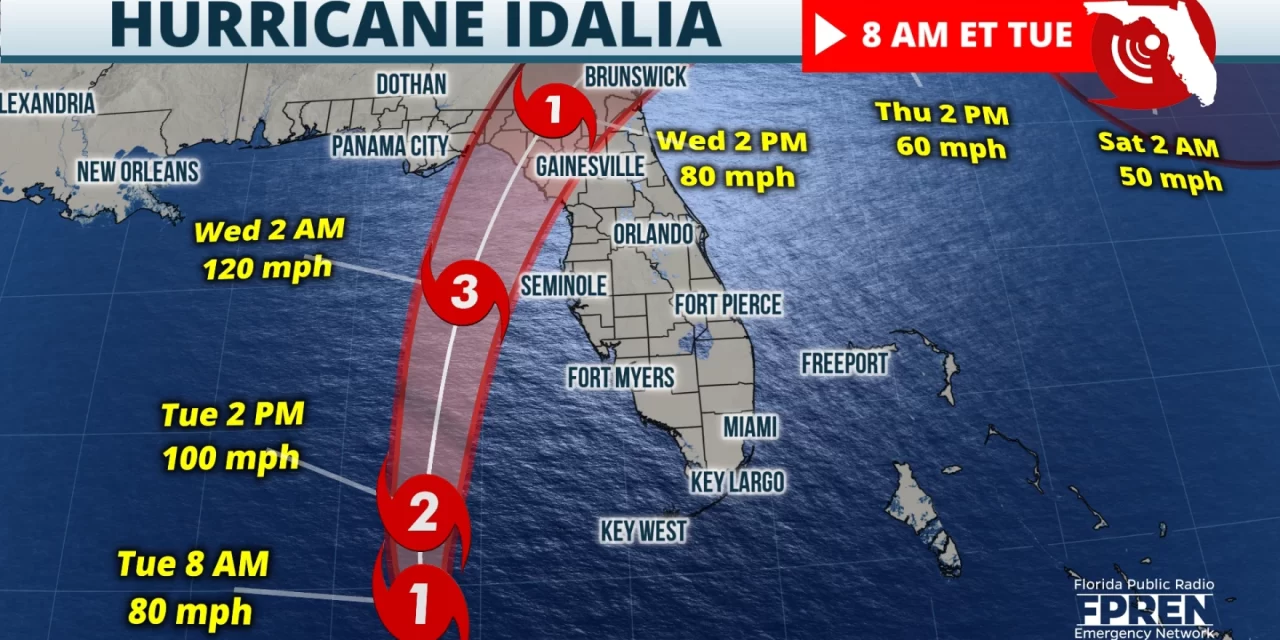
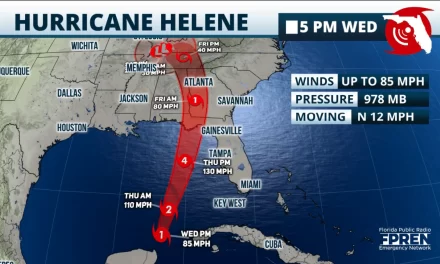
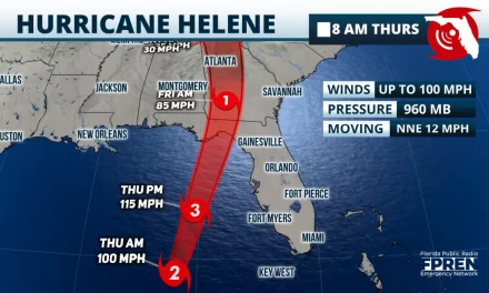
FPREN HQ – The forecast continues for Idalia to strengthen into a major category 3 hurricane and make landfall early Wednesday somewhere across the Big Bend Coast of Florida. Depending on the final track, hurricane force winds over 100 mph may spread well into the Panhandle & down the west coast. Hurricane and Tropical Storm Warnings cover most of the Panhandle and Peninsula.
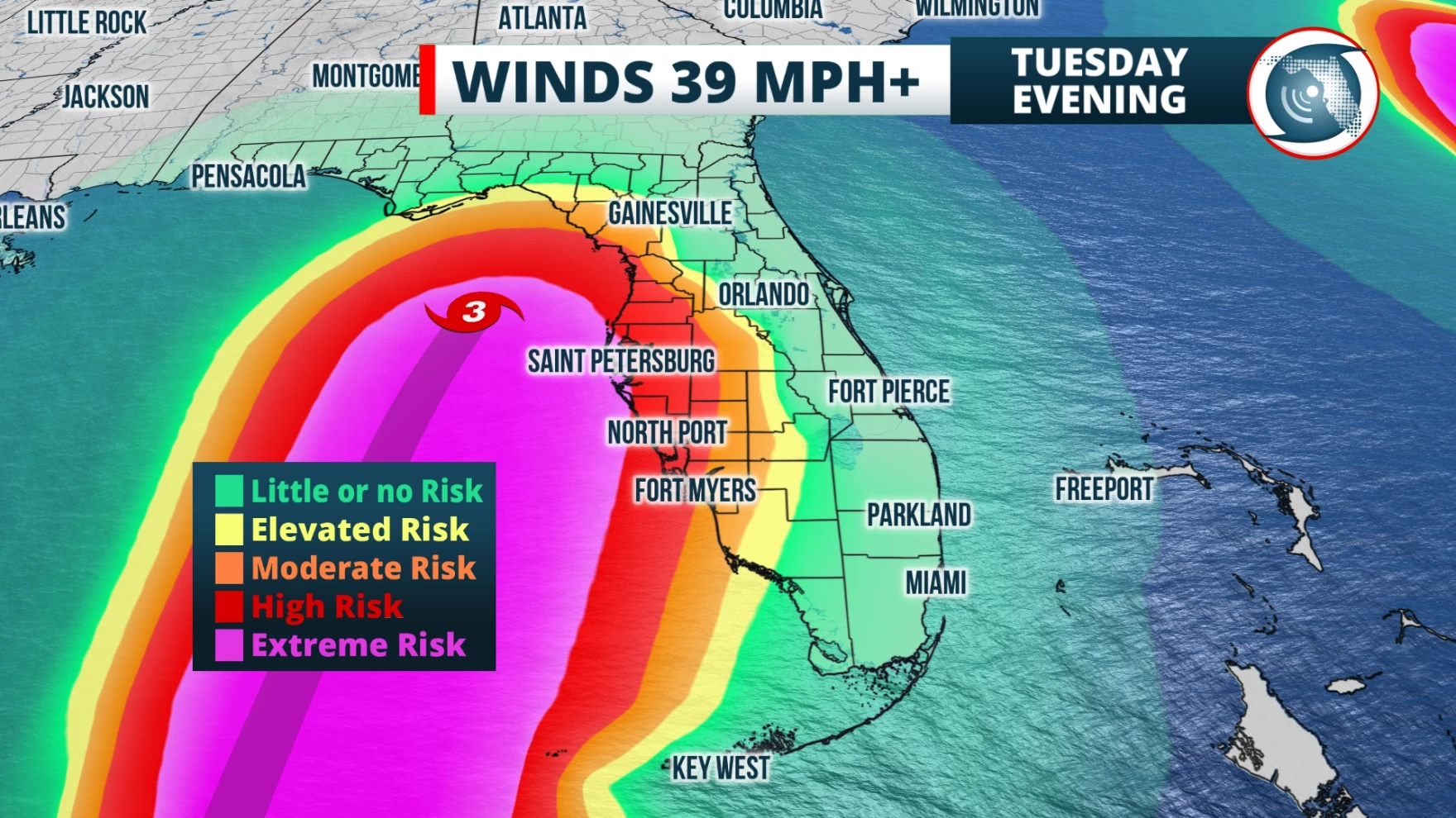
Residents are encouraged to have hurricane preparations finished today as tropical storm conditions are expected to start hitting parts of the Gulf Coast this afternoon or evening. Please keep in mind significant impacts will be felt well outside the cone and local preparations should stretch across the warning areas.
Evacuation orders have been issued for many counties. If you are under an evacuation, take it seriously and move to a safer area. Here is the list of affected counties: https://www.floridadisaster.org/evacuation-orders/
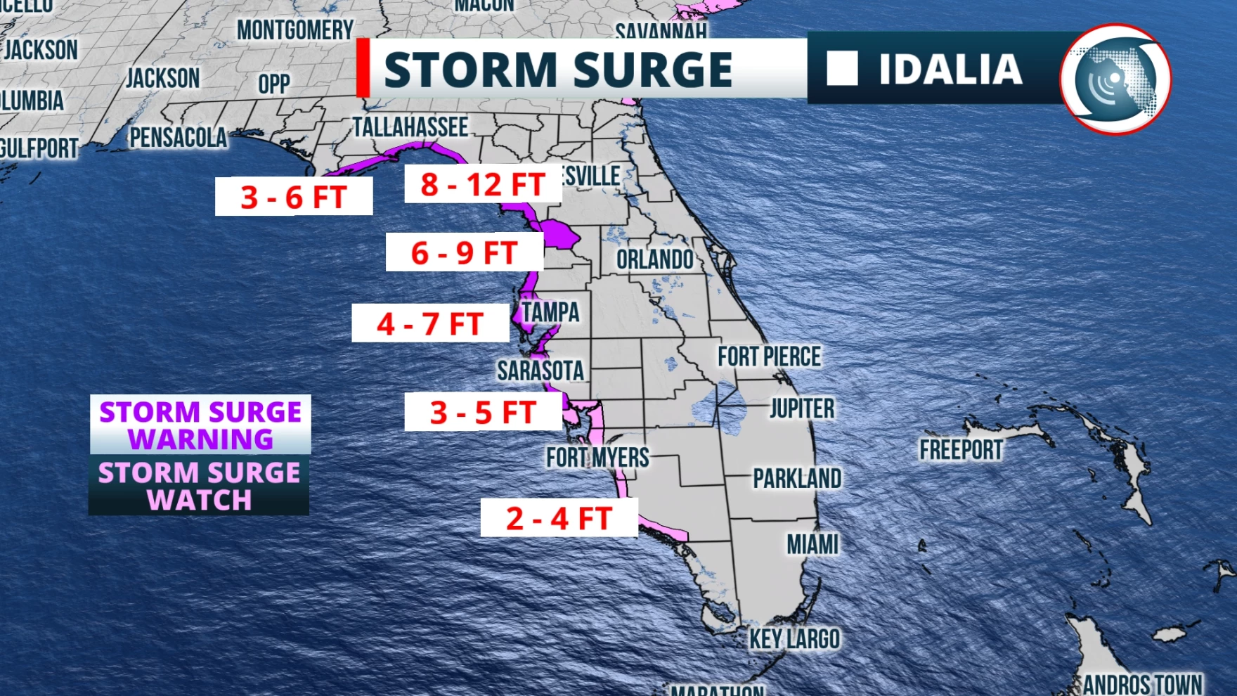
Life-threatening storm surge will be one of the greatest impacts and warnings are posted from the Panhandle to the south Peninsula. Across this area, inundations will average 3-7 feet to include Tampa/St. Pete. But the Big Bend Coast is much more susceptible and will need to plan for inundations possibly up to 12 feet.
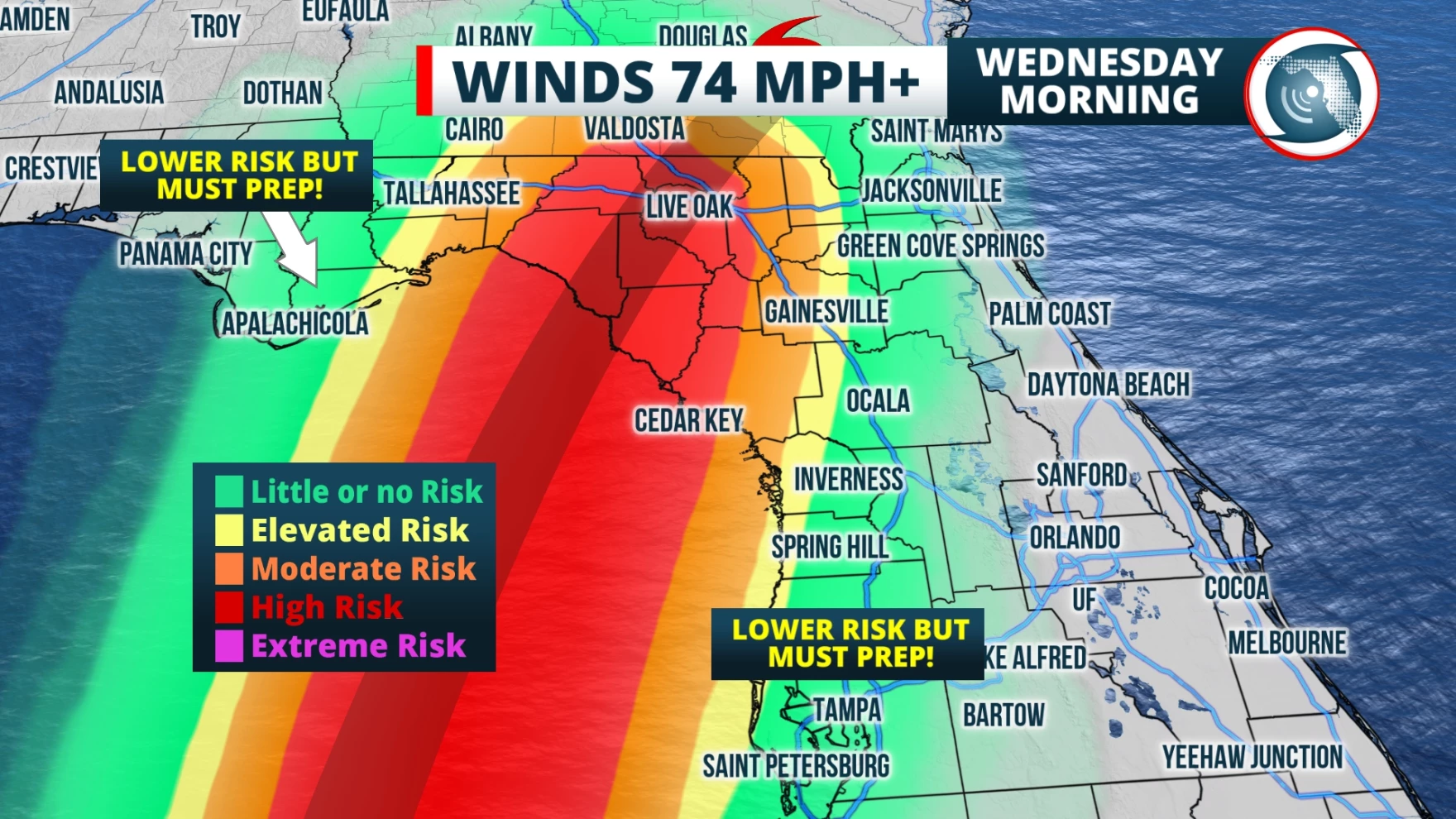
If Idalia makes landfall as a category 3 hurricane as expected, sustained winds of 111-129 mph are likely near the center of circulation along the immediate coastal areas. Idalia is expected to remain a category 1 or 2 as it tracks across the state Wednesday. That means winds will range from 74 mph to possibly over 100 mph closest to the eyewall. Winds will decrease farther from the center, but strong gusts will likely cause power outages along with tree and structural damage. Isolated tornadoes are also possible in any of the outer rain bands across the state.
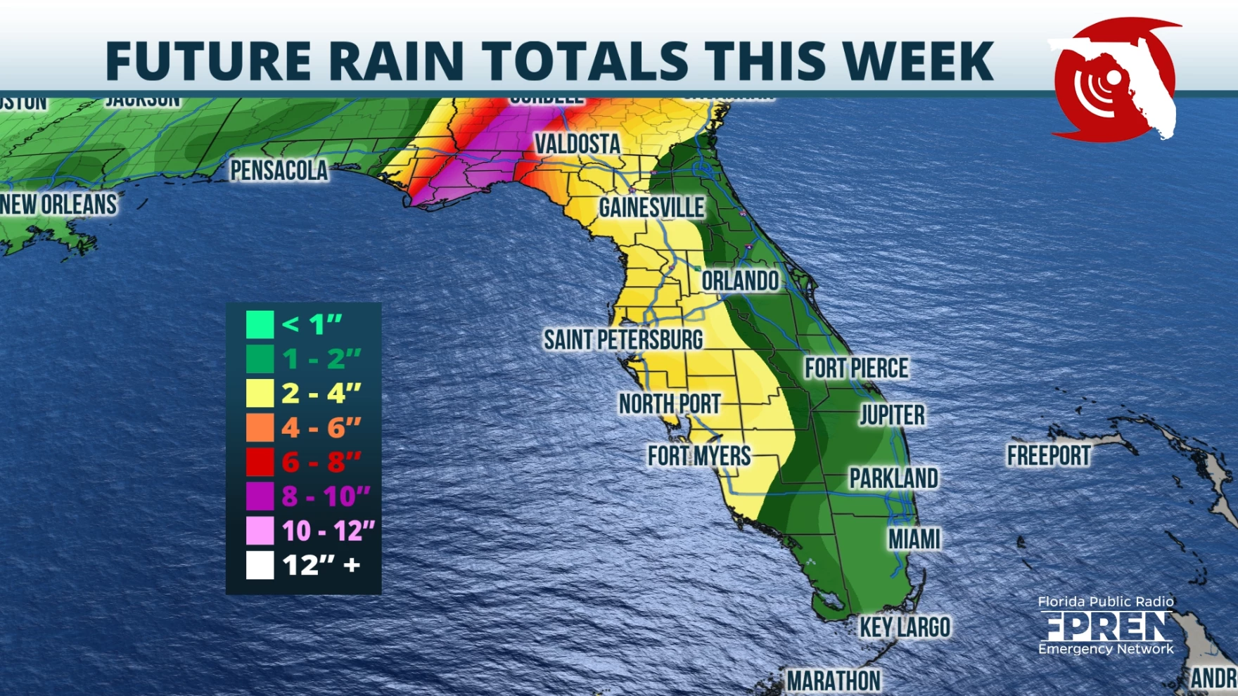
Based on Idalia’s current track, areas closest to the path can expect 3-7”of rain on average, and locally up to 10 or more inches. Areas well inland across the Panhandle and Peninsula could possibly receive 2-5” of rain with locally higher amounts.
It’s important to remember that most tropical cyclone-related fatalities are due to the high waters caused by flooding and storm surge. Consider the following advice: hide from the wind, run from the water.
Traveling across impacted areas on Wednesday will be dangerous and highly discouraged. Download the Florida Storms app to keep you safe and informed at all times.
Story by Chief Meteorologist Jeff George of FPREN.
